Top banner
The World Factbook Banner

         
  Baker Island
(territory of the US)
 
Flag of Baker Island
Click to enlarge
Categories Banner
 Introduction
 Geography
 People
 Government
 Economy
 Communications
 Transportation
 Military
 Transnational Issues

This page was last updated on 20 October, 2005


Map of Baker Island


Legend: DefinitionDefinition Field ListingField Listing Rank OrderRank Order
   Introduction    Baker Island Top of Page
Background:
Definition Field Listing
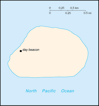
The US took possession of the island in 1857, and its guano deposits were mined by US and British companies during the second half of the 19th century. In 1935, a short-lived attempt at colonization was begun on this island - as well as on nearby Howland Island - but was disrupted by World War II and thereafter abandoned. Presently the island is a National Wildlife Refuge run by the US Department of the Interior; a day beacon is situated near the middle of the west coast.
   Geography    Baker Island Top of Page
Location:
Definition Field Listing
Oceania, atoll in the North Pacific Ocean, about half way between Hawaii and Australia
Geographic coordinates:
Definition Field Listing
0 13 N, 176 31 W
Map references:
Definition Field Listing
Oceania
Area:
Definition Field Listing Rank Order
total: 1.4 sq km
land: 1.4 sq km
water: 0 sq km
Area - comparative:
Definition Field Listing
about 2.5 times the size of The Mall in Washington, DC
Land boundaries:
Definition Field Listing
0 km
Coastline:
Definition Field Listing
4.8 km
Maritime claims:
Definition Field Listing
territorial sea: 12 nm
exclusive economic zone: 200 nm
Climate:
Definition Field Listing
equatorial; scant rainfall, constant wind, burning sun
Terrain:
Definition Field Listing
low, nearly level coral island surrounded by a narrow fringing reef
Elevation extremes:
Definition Field Listing
lowest point: Pacific Ocean 0 m
highest point: unnamed location 8 m
Natural resources:
Definition Field Listing
guano (deposits worked until 1891), terrestrial and aquatic wildlife
Land use:
Definition Field Listing
arable land: 0%
permanent crops: 0%
other: 100% (2001)
Irrigated land:
Definition Field Listing
0 sq km (1998 est.)
Natural hazards:
Definition Field Listing
the narrow fringing reef surrounding the island can be a maritime hazard
Environment - current issues:
Definition Field Listing
no natural fresh water resources
Geography - note:
Definition Field Listing
treeless, sparse, and scattered vegetation consisting of grasses, prostrate vines, and low growing shrubs; primarily a nesting, roosting, and foraging habitat for seabirds, shorebirds, and marine wildlife
   People    Baker Island Top of Page
Population:
Definition Field Listing Rank Order
uninhabited
note: American civilians evacuated in 1942 after Japanese air and naval attacks during World War II; occupied by US military during World War II, but abandoned after the war; public entry is by special-use permit from US Fish and Wildlife Service only and generally restricted to scientists and educators; a cemetery and remnants of structures from early settlement are located near the middle of the west coast; visited annually by US Fish and Wildlife Service (2005 est.)
   Government    Baker Island Top of Page
Country name:
Definition Field Listing
conventional long form: none
conventional short form: Baker Island
Dependency status:
Definition Field Listing
unincorporated territory of the US; administered from Washington, DC, by the Fish and Wildlife Service of the US Department of the Interior as part of the National Wildlife Refuge system
Legal system:
Definition Field Listing
the laws of the US, where applicable, apply
Flag description:
Definition Field Listing
the flag of the US is used
   Economy    Baker Island Top of Page
Economy - overview:
Definition Field Listing
no economic activity

   Transportation    Baker Island Top of Page
Ports and harbors:
Definition Field Listing
none; offshore anchorage only; note - there is one small boat landing area along the middle of the west coast
Airports:
Definition Field Listing Rank Order
1 abandoned World War II runway of 1,665 m, completely covered with vegetation and unusable (2004 est.)
Transportation - note:
Definition Field Listing
there is a day beacon near the middle of the west coast
   Military    Baker Island Top of Page
Military - note:
Definition Field Listing
defense is the responsibility of the US; visited annually by the US Coast Guard
   Transnational Issues    Baker Island Top of Page
Disputes - international:
Definition Field Listing
none

This page was last updated on 20 October, 2005


Bottom Banner