|
|
Legend:
 Definition Definition
 Field Listing Field Listing
 Rank Order Rank Order
|
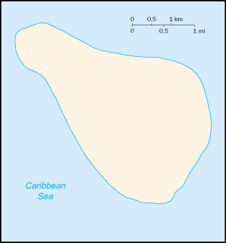
Background:
|
This uninhabited island was claimed by the US in 1857 for its guano. Mining took place between 1865 and 1898. The lighthouse, built in 1917, was shut down in 1996 and administration of Navassa Island transferred from the Coast Guard to the Department of the Interior. A 1998 scientific expedition to the island described it as a unique preserve of Caribbean biodiversity; the following year it became a National Wildlife Refuge and annual scientific expeditions have continued.
|
|
Economy - overview:
|
subsistence fishing and commercial trawling activities within refuge waters
|
|
Ports and harbors:
|
none; offshore anchorage only
|
|
Military - note:
|
defense is the responsibility of the US
|
|
Disputes - international:
|
claimed by Haiti, source of subsistence fishing
|
This page was last updated on 20 October, 2005
|